
Walk a Lafayette Street Directory
Begin with the full current address, including apartment, directional, and street suffix. LCG Development and Planning issues municipal addresses for Lafayette and several nearby jurisdictions and maintains a Point Address Layer with GIS. Its corporate-limit check separates Lafayette, Carencro, Broussard, Duson, Scott, Youngsville, and unincorporated Lafayette Parish. This step prevents a postal city label from being mistaken for city jurisdiction.
Next, connect the point address to a parcel. The parcel number and legal description remain useful when a street number or name changes. Only after that match should a researcher add ownership, deed parties, voter clues, or an older directory occupant.
- Normalize the street through the LCG Master Street Index and Point Address Layer.
- Search Beacon by address, then record the parcel, alternate ID, ownership, and map position.
- Separate the physical situs from the tax mailing address shown by the Assessor.
- Take the parcel and legal description to the Clerk's vendor and vendee indexes.
- Check the public voter address mode and dated criss-cross directories without treating either as a full household list.
Lafayette Street Assessor Fields
The Assessor property form exposes only a narrow set of fields. Its Business Owner Name field searches business personal property. Real-estate parameters other than an assessment number move to the linked Beacon GIS. That split is crucial for street directory work because a failed name search on the first form does not mean there is no real-estate parcel.
| Field or mode | Type | Required | Street-search use |
|---|---|---|---|
| Account Number | Text | Not marked | Real estate or business assessment |
| Business Owner Name | Text | Not marked | Business personal property only |
| Search by address | Beacon mode | Not observed | Street and situs match |
| Search by parcel ID | Beacon mode | Not observed | Stable parcel lookup |
| Map selection | Map control | Not observed | Adjacent parcel route |
The official Beacon route appears in this Lafayette parcel-viewer screen.
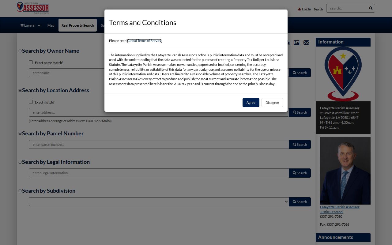
The live viewer is dynamic, so save the visible field names and access date. Never invent required settings or map tools that the loaded screen does not show.
Lafayette Street Records Coverage
No Lafayette street directory source proves every occupant. The best record depends on whether the question concerns current title, a recorded transfer, a historical household, a map change, or postal geography.
| Address record | Verified depth | Street detail to keep | Access |
|---|---|---|---|
| Assessor and Beacon | Current roll; historic depth not shown | Owner, parcel, situs, mailing, ASV | Online, office, phone |
| Clerk conveyances | Vendor 1935; vendee 1966; images 1935 | Party role, file, date, legal description | eSearch, eClerks, counter |
| Voter address mode | Current portal; start not shown | Public result and precinct only | Online or Registrar |
| City directories | Many years from 1946; scattered earlier years | Name, address, year, page | Library and archives |
| Sanborn maps | 1903 and 1912 verified | Block, footprint, use, street number | Library of Congress |
| Permit and code records | Current portal gap | Property, project, permit, date | MGO or JustFOIA |
The sources chain through the parcel and legal description, not through a bare surname. If an online image is gated, call Clerk Land Research at 337-291-6300 or request the specific instrument. The Assessor answers tax-roll questions at 337-291-7080.
Read Lafayette Street Address Types
Address labels should remain separate. Combining them into one field can turn a valid record into a false claim about who lives on a Lafayette street.
- Situs address
- The physical location assigned to the parcel or building.
- Mailing address
- Where tax notices go; it may be a box, agent, or another city.
- Parcel
- A mapped unit of land with an assessment identifier.
- Plat
- A recorded map of lots, blocks, roads, or a subdivision.
- Criss-cross directory
- A volume arranged by street address, often used for a dated occupant search.
The Assessor's mailing-address change form shows that correspondence can change without moving the parcel. Likewise, LCG can issue a new point address without changing title. A street directory result should state which address type appears and which source supplied it.
Lafayette Streets Enter Deed Indexes
The Clerk's land system is searched by parties and instruments, so first bring over the parcel, legal description, and current owner. Search Conveyances-Vendor and Conveyances-Vendee in both directions. A current owner may be the vendee on an acquisition and later the vendor on a transfer. Estates, trusts, and entities need their exact legal names and useful spelling variants.
Record the index type, party role, file number, date and time, document type, pages, and linked image. Search mortgages, cancellations, plats, adjudications, and UCC rows separately because none means the same thing as a deed. When a street search fails, a subdivision, addition, lot, or block can reconnect the parcel to the right instrument.
Note: Some Lafayette plats require the Clerk's filing-cabinet route even when the online result has no useful map.
Lafayette Street Maps Keep Moving
LCG reported 2,664 new address points, more than 350 road centerlines, 12 annexation updates, and 55 zoning updates in its 2025 annual report. Those figures show why a street directory screenshot needs a date. The local address layer is maintained, not frozen.
Downloadable LCG maps include city and parish streets, municipalities, precincts, voter precincts, council districts, and judicial districts. A street can cross a city limit, ward, or precinct while keeping one familiar name. The USPS ZIP tool answers delivery geography, not municipal jurisdiction. ZIP, city limits, parcel location, and voter precinct are separate layers.
No official citywide renumbering table was located. For an old address, test directional variants, road aliases, historic subdivision names, legal description, nearby parcels, and newspaper wording before deciding the location disappeared.
Freetown in Lafayette Street Research
Neighborhood and addition names can unlock records when a modern street name cannot. Freetown-Port Rico lies northeast of UL Lafayette and includes the original Mouton Addition. The official planning account describes African, Cajun, Lebanese and Middle Eastern, Greek, Spanish, and Irish communities, along with the True Friends Society and Good Hope Hall. These details offer search terms, not proof of any person's identity.
The official Freetown-Port Rico Coterie page preserves boundaries, history, and a public planning contact.
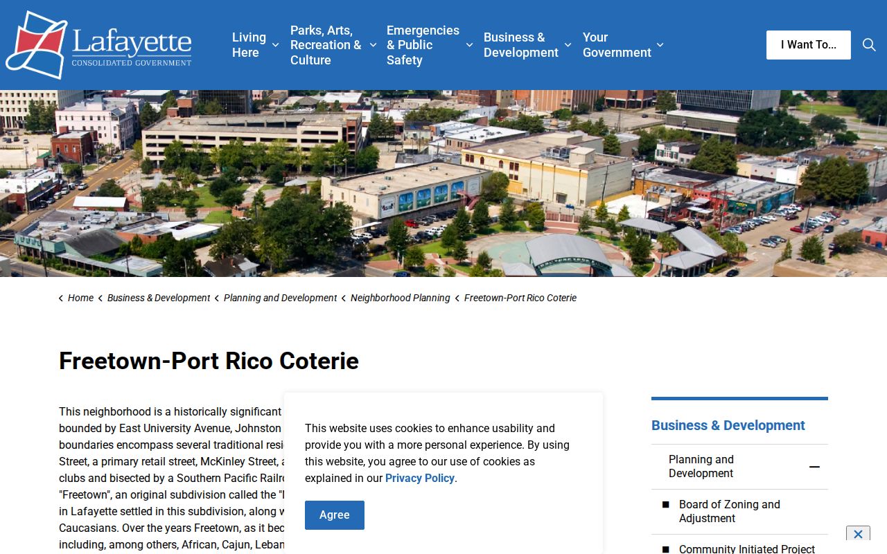
The page can connect an addition or cultural place-name to city minutes, plats, maps, and newspapers, but it does not publish a resident roster.
Historic Lafayette Streets by Directory
A criss-cross volume can place a printed name beside an address in one year. Verified Lafayette directory holdings include 1939, 1941, 1946, 1949, 1952, 1955, and 1957 through 1959, with local leads for many years from 1946 forward. Ask the library which volumes have street sections because not every run is complete or arranged the same way.
For an older block, compare the 1903 five-sheet and 1912 ten-sheet Sanborn sets. Their street widths, building footprints, lot lines, and use labels can translate a historic address into current parcel geography. The Lafayette city directory collections hold the full historical shelf method.
Lafayette Street Request Fallbacks
Online access includes Assessor, Beacon, land eSearch, eClerks, voter address mode, USPS, and LCG maps. In person, the Assessor is at 213 W. Vermilion Street and Clerk Land Records is at 800 S. Buchanan Street. Development and Planning handles municipal address questions, while library and archive desks handle older directory and map material.
Use LCG JustFOIA for address points, permits, code files, maps, road centerlines, or annexation records not published. Give the exact address, parcel, department, and date range. Recorded instruments require the Clerk's own copy or research channel. Historical fallbacks include UL Lafayette room 314, Lafayette Public Library's second-floor local-history collection, the State Library's Louisiana Collection, State Archives microfilm with permission, and Library of Congress Sanborn images.
A good request names the record rather than asking who lives on a whole street. For a permit, provide the property address, parcel, project type, and date span. For a deed, provide a party, instrument number, legal description, or likely recording date. For a disputed municipal address, include the current number, old spelling, nearby cross street, and corporate-limit question. This detail helps LCG or the Clerk locate a file and state any fee before copies are made.
If the live map fails, do not replace it with a commercial guess. Ask Development and Planning about the Master Street Index or point-address layer, ask the Assessor for the tax parcel, and ask the Clerk about a certified instrument. Those channels preserve the difference between an address assignment, tax ownership, and legal title.
Limits of Lafayette Street Directory
A tax owner is not necessarily a current occupant. A voter result does not list all residents. A directory entry can be decades old, and USPS warns that a ZIP result does not confirm a person or company at an address. Utility, motor-vehicle, confidential voter, and Address Confidentiality Program information is not converted into a public household list.
A trust, estate, company, or public body can hold title. A homestead exemption may support an owner-occupancy clue, but it does not prove who is present today. Tax mail can go to a post-office box or agent. Likewise, a directory line says what a publisher printed in one year, while a deed party address can be old or outside Lafayette. These differences are normal, not errors to be blended away.
State what a source actually says: parcel owner, deed party, registered voter result, directory occupant, permit applicant, or historical notice subject. Date the result and avoid publishing protected birth data, identity numbers, confidential addresses, or guesses about occupancy. When two sources conflict, return to the parcel, legal description, and record date. Ask the custodian for the document rather than selecting the more convenient name.
Lawful use. Lafayette address records are for lawful personal research. Never use a street result to stalk, harass, intimidate, or harm a person.