
Lafayette ZIP Directory Coverage
Lafayette postal geography includes standard delivery sectors, P.O. Box routes, and codes assigned to a university or another organization. This is a working coverage chart, not a map of city limits. Run a mailing address through the USPS ZIP Code Lookup before using a row as proof. USPS cautions that a returned code does not prove a named person or company occupies the address.
| ZIP | Area or role | Post office | Research note |
|---|---|---|---|
| 70501 | Central and east standard delivery | Lafayette | Verify exact street |
| 70502 | P.O. Box sector | Lafayette | Not parcel geography |
| 70503 | South and southwest standard delivery | Lafayette | Compare city edges |
| 70504 | University organization code | Lafayette | Not a neighborhood |
| 70505 | P.O. Box sector | Lafayette | Mail route only |
| 70506 | West and northwest standard delivery | Lafayette | Check by address |
| 70507 | North standard delivery | Lafayette | Check municipal line |
| 70508 | South standard delivery and institutions | Lafayette | Confirm each address |
| 70509 | P.O. Box sector | Lafayette | Not a block |
| 70593 | Box or organization sector | Lafayette | Validate physical site |
| 70596 | Box or organization sector | Lafayette | Do not map as a block |
| 70598 | Unique organization sector | Lafayette | Not parcel geography |
This mix is the key quirk in the Lafayette ZIP code directory. Codes 70502, 70505, and 70509 commonly point to boxes, while 70504 and 70598 serve specialized delivery. A name attached to one may belong to an agency, school, firm, or mailing contact. It does not establish where someone lives, owns land, or votes.
USPS Fields for Lafayette ZIPs
The USPS tool has three search paths. Use the mode that matches the known fact. An address query is strongest for one property. City and state returns codes attached to a postal label. Cities by ZIP reveals recognized place names for one code.
| Mode | Required input | Result | Limit |
|---|---|---|---|
| By address | Street, city, state | Specific ZIP and city | Does not confirm occupant |
| By city and state | City and state | Codes for city label | Not a city boundary |
| Cities by ZIP | ZIP | Recognized city names | May list several names |
Company and unit fields help narrow the address mode. Save the recognized city exactly as returned. If several matches appear, add the apartment, suite, or lot. Pair the postal answer with LCG before describing the site as inside Lafayette.
The successful source capture comes from the official USPS lookup.
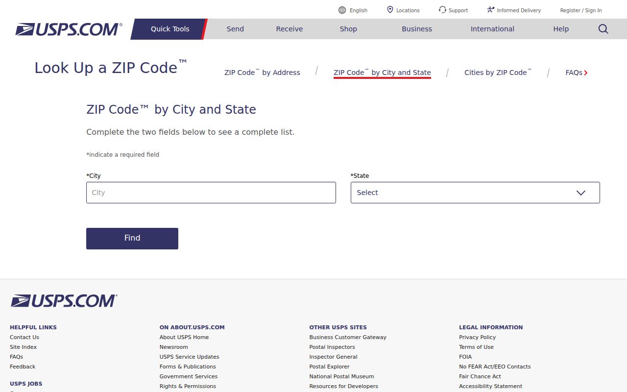
The screen supports all three postal queries, while Lafayette records supply jurisdiction and identity context.
Find Lafayette Residents by ZIP
A ZIP is a useful filter, but it is a poor final answer. The Louisiana voter portal accepts ZIP in voter and address modes. Unclaimed property can use ZIP as an optional filter. Neither turns a postal code into current residence proof. Assessor and Clerk searches were not verified as ZIP-filtered tools, so they should not be described that way.
- Enter the exact street and unit in USPS to confirm the delivery code and city.
- Check the LCG Point Address Layer for government jurisdiction.
- Use the Louisiana voter address mode for a legitimate registration question.
- Open the Lafayette Parish Assessor search or Beacon by address and preserve parcel, owner label, municipality, and legal description.
- Move to the Lafayette street directory when the task narrows to one street.
For a broad request, the Secretary of State offers an order route for voter lists with an estimate and prepayment. It is not a free live export. Protected fields remain excluded, and the list date must remain attached to any result.
Lafayette City Lines and ZIPs
USPS maintains delivery geography. Lafayette Consolidated Government determines municipal address jurisdiction. LCG says Development issues addresses for Lafayette, unincorporated Lafayette Parish, Carencro, Scott, and Youngsville, and works with GIS on a Point Address Layer. It can distinguish Broussard and Duson as well.
Census ZIP Code Tabulation Areas, or ZCTAs, are statistical approximations. Lafayette city fully or partly overlaps 70501, 70503, 70506, 70507, 70508, 70518, 70583, and 70592. The last three are tied broadly to Broussard, Scott, and Youngsville postal geography. Overlap does not relabel every address as Lafayette.
- ZIP+4
- Four added digits that narrow delivery within a ZIP.
- P.O. Box ZIP
- A code for box mail, not a residential area.
- Unique ZIP
- A code assigned to a high-volume organization.
- Carrier route
- A postal path that may cross neighborhood lines.
- ZCTA
- A Census area approximating ZIP geography.
Keep four fields. Record postal city and ZIP, municipal limit, Lafayette Parish status, and voter precinct as separate facts.
Lafayette Address Geography Changes
Lafayette address geography is maintained, not frozen. The LCG 2025 annual report states that GIS added 2,664 address points, more than 350 road centerlines, and 12 annexation updates. A new point or changed jurisdiction can explain why an old directory, deed, and current mail result disagree.
Use LCG downloadable maps for streets, precincts, councils, and municipalities. Date-stamp the map because layers change. For an old or disputed number, the Master Street Index and Development address office are better than guessing from a present ZIP code directory.
The Census Lafayette profile supplies statistical geography, not delivery proof.
This view can measure overlap, but USPS and LCG still control postal and municipal answers.
Historical Lafayette ZIP Research
Modern ZIP codes should not be projected backward onto most pre-1960 Lafayette sources. Old newspapers may use a ward, rural route, landmark, or post-office name. Directories preserve old spellings or numbers. Sanborn maps from 1903 and 1912 show blocks before the modern system.
Start with the record date. Compare the printed address with a directory from the same era, a Sanborn sheet, and the Clerk legal description. Then use the current Master Street Index and parcel map to translate it forward. This avoids attaching a modern Lafayette ZIP code directory label to a household that never used it.
When maps do not settle an annexation or road change, file a narrow request through LCG JustFOIA. Ask for the exact address-point or annexation record and give a date range. The tracked system launched in March 2025 and can issue a request ID and fee notice.
Note: A current Lafayette ZIP result is a postal snapshot, not evidence that the same code described an earlier household or street.
Lafayette ZIP Access Channels
Online tools are only the first channel. USPS handles delivery labels. LCG Development handles municipal addresses, while GIS publishes street and jurisdiction maps. Assessor and Beacon tie an address to a parish parcel. The Registrar can explain registration geography at 337-291-7140, and the Clerk can resolve deeds, plats, and legal descriptions.
For a phone or counter fallback, call LCG through 337-291-8200 or 311 for address and GIS routing. Call Clerk Land Records at 337-291-6300 for instruments. Libraries, UL Special Collections, the State Library, State Archives, and Library of Congress maps cover historic numbering.
This split makes the Lafayette ZIP code directory more accurate. Postal staff should not decide city limits, and parcel staff should not certify a mail route. Keep each answer with its source and date.
Check Lafayette ZIP Evidence
A reliable ZIP worksheet keeps one row for every address being tested. Copy the spelling and unit from the original record first. Add the USPS code and recognized city, the LCG municipality result, the Assessor parcel number, and the voter precinct only when that field serves the question. A conflict is useful evidence. It may point to a box address, an annexation, a renamed road, or a record created under an older address system.
The Lafayette Parish Clerk becomes important when a postal result cannot identify the land. Recorded plats and conveyances use legal descriptions that survive many street and mailing changes. Search the subdivision, addition, lot, and block terms found on the parcel card. If a current street number does not appear in the deed image, compare the legal description instead of rejecting the match.
For historical work, preserve both the printed place name and the modern interpretation. A Lafayette Gazette notice, city directory line, or Sanborn sheet should be cited as it appeared. Then state separately how LCG, USPS, or the Assessor identifies that location now. This two-date method prevents a modern ZIP label from silently rewriting the older source.
Finally, verify any result before using it for contact or family research. A parcel owner can receive mail elsewhere. A voter result can change. A P.O. Box can serve many kinds of organizations. The Lafayette ZIP code directory narrows the search area, while the underlying official record supplies the actual claim.